


New Zealand Topo Maps
New Zealand Topo Maps leírása
Könnyen kezelhető kültéri navigációs alkalmazás Új-Zéland, Cook-szigetek és Tokelau legújabb topográfiai térképével.
Ez az alkalmazás hasonló térképezési lehetőségeket nyújt, mint amiket a Garmin vagy a Magellan GPS kézi eszközökből tudhat.
A kültéri navigáció főbb jellemzői:
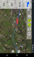
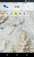
• Útpontok létrehozása és szerkesztése
• GoTo-Waypoint-Navigation
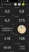
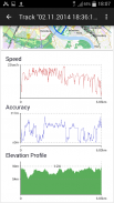
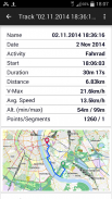
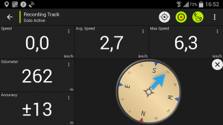
• Sáv rögzítése (sebesség, magasság és pontossági profil)
• Tripmaster mezőkkel a kilométer-számlálóhoz, az átlagos sebességhez, csapágyhoz, magassághoz stb.
• GPX-Import / Export, KML-Export
• Keresés (helynevek, POI-k, utcák)
• Testreszabható adatmezők a Térképnézetben és a Tripmasterben (például Sebesség, Távolság, Iránytű, ...)
• Útpontok, nyomvonalak vagy útvonalak megosztása (e-mailben, Facebookon, ..)
• Használja az UTM, WGS84 vagy MGRS koordinátákat
• és még sok más ...
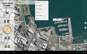
Elérhető alaptér rétegek:
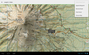
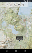
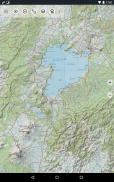
• Topomaps Új-Zéland (zökkenőmentes lefedettség az 1: 250 000 és 1: 50 000 skálán)
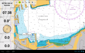
• NZMariner (RNC hajózási táblázatok)
• LINZ légifelvételek
• Google Maps (műholdas képek, út- és tereptérkép)
• Nyissa meg az utcai térképeket
• Bing Maps
• ESRI Maps
Fedvény rétegek:
• Közvédelmi természetvédelmi területek
• Nyitott vadászati területek
• DOC táborhelyek
• DOC szabadság-kemping korlátozások
• DOC kunyhók
• DOC TRACks
• Taupo-pisztránghalászati körzet
• Hillshading
Használja ezt a navigációs alkalmazást kültéri tevékenységekhez, például túrázáshoz, kerékpározáshoz, kempinghez, hegymászáshoz, lovagláshoz, síeléshez, kenuzáshoz vagy offroad 4WD túrákhoz.
Töltse fel az INGYENES térképadatokat a cellás szolgáltatás nélküli területeken. (Csak Pro verzió)
A SZABAD VÁLTOZÁS KORLÁTOZÁSAI:
• Hirdetések
• Max. 3 Útpont
• Max. 3 szám
• Nincs útvonal
• Az importpontok és a pályák importálása nem lehetséges
• Nincs tömeges letöltés
• Nincs helyi városi DB (offline keresés)
A topográfiai térképeket a Land Information New Zealand (LINZ) készítette.
A Topo50 az új-zélandi sürgősségi szolgálatok által használt hivatalos topográfiai térkép-sorozat.
A topográfiai információk felhasználása
Védelmi tervezés: Az új-zélandi védelmi erők topográfiai információkat használnak a katonai gyakorlatok tervezésére és az információcsere a nemzetközi partnerekkel.
Helyszín és útvonal: A kutatás és mentés, a védelem, a mentő, a tűzoltóság, a rendőrség és a polgári védelmi ügynökségek a topográfiai információkat sokféle tervezési és működési helyzetben használják, a természeti katasztrófáktól a közösségi rendőrségig. A felhasználás magában foglalhatja a mobil / terepi és a vezérlőhelyiség helyzeteit, valamint a topográfiai információk és más adatok kombinációját.
Földgazdálkodás: A topográfiai információkat a helyi önkormányzatok használják a regionális tervezéshez és a műveletekhez, valamint az energia-, gáz- és távközlési társaságok.
Ezen túlmenően a LINZ térképeket különféle célokra használják vállalkozások és kormányzati szervek, például a Természetvédelmi Minisztérium, és a szabadidős felhasználók, például a tramplók és a turisták.
Minden topográfiai térképen további címkék vannak a jobb olvashatóság érdekében a nagyobb zoom skálán. A térképeket Atlogis® hegyvidéki árnyékolással jelenítik meg a topográfia javítása érdekében.
Topo térkép lefedettség:
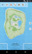
Új-Zéland és szigetek (Antipódok, Auckland, Bounty, Campbell, Chatham, Kermadec, Raoul, Snares és Stewart-szigetek) 1: 50 000 és 1: 250 000 méretben
Cook-szigetek (Aitutaki, Atiu, Mangaia, Manihiki, Mauke, Mitiaro, Palmerston, Penrhyn, Pukapuka, Rakahanga, Rarotonga, Suwarrow, Takute) 1: 25 000 méretarányban
Tokelau-szigetek (Atafu, Nukunonu, Fakaofo) méretarányban 1: 25.000
Kérjük, küldje el észrevételeit és szolgáltatáskéréseit az nzmaps@atlogis.com címre
New Zealand Topo Maps - APK információ
APK verzió: 7.5.1Csomag: com.atlogis.nzmaps.freeNew Zealand Topo Maps legújabb verziója
Egyéb változatok


Appok ebben a kategóriában


